Bowman Secures Landmark Contract to Provide High-Resolution Aerial Orthoimagery for Oklahoma
Bowman Consulting Group Ltd. (NASDAQ: BWMN), a national engineering services firm specializing in infrastructure solutions and program management, has been awarded a pivotal two-year contract to deliver high-resolution aerial orthoimagery for the State of Oklahoma. This initiative represents the first comprehensive statewide leaf-off aerial mapping project undertaken in nearly three decades, signifying a major investment in modernized geospatial data for the benefit of state agencies, municipalities, and the general public.
Scope and Objectives of the Project
Under this contract, Bowman will capture high-resolution, four-band, 6-inch resolution digital orthoimagery across approximately 70,000 square miles of Oklahoma. This effort will take place during the leaf-off seasons when tree cover is at a minimum, ensuring optimal visibility of crucial land features such as creek beds, roads, infrastructure, and housing developments. The project will not only encompass the entire state but also extend one mile beyond its borders, ensuring comprehensive coverage that benefits both in-state planning and cross-boundary collaboration.
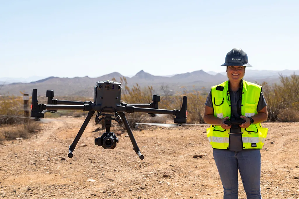
Bowman will leverage cutting-edge high-altitude imaging technology, a capability acquired through its recent purchase of Surdex, to execute this large-scale mapping initiative. By combining advanced aerial data collection techniques with real-time ground condition reports from local stakeholders, the company aims to enhance the accuracy and utility of the imagery. This approach ensures that the data meets the highest standards for clarity, precision, and applicability across multiple domains.
Strategic Importance for Bowman
The award of this contract marks a significant milestone for Bowman, as it expands its footprint in the geospatial and engineering sectors. Chairman and CEO Gary Bowman emphasized the importance of this project within the company’s broader strategic growth plan.

“This contract marks Bowman’s first orthoimagery project with the State of Oklahoma, a state where we have existing public and private terrestrial engineering assignments,” said Bowman. “Awards like this validate our strategic growth initiative of generating short- and long-term revenue synergy and organic growth from companies we acquire and integrate. We are honored to have been selected by the State to apply our geospatial and technical engineering expertise to a project of this scale and importance.”
The contract also underscores the increasing demand for high-quality geospatial data across various sectors, including transportation, emergency response, environmental conservation, and urban planning. By securing this contract, Bowman reinforces its position as a leader in the industry, capable of executing large-scale mapping initiatives that provide critical data for decision-making at the state and municipal levels.
Applications and Benefits of the Orthoimagery Data
The high-resolution orthoimagery collected by Bowman will serve a wide range of applications across multiple state agencies and organizations. Some of the key beneficiaries include:
- Oklahoma Department of Transportation (ODOT)
- Improved planning and maintenance of roads, highways, and bridges.
- Enhanced ability to assess transportation corridors and optimize infrastructure investments.
- Emergency 911 Services
- More accurate mapping for emergency response teams.
- Enhanced location tracking to improve response times and efficiency.
- Oklahoma Conservation Commission
- Better monitoring of environmental changes and land use patterns.
- Support for conservation planning and habitat preservation.
- Office of Geographic Information
- Centralized access to up-to-date geospatial data for state agencies.
- Improved decision-making capabilities for urban and rural planning initiatives.
- Municipal Governments and Public Stakeholders
- Access to high-quality imagery for zoning, property assessment, and urban development projects.
- Improved transparency and public engagement through open access to geospatial data.
By making the orthoimagery publicly accessible, the State of Oklahoma ensures that a broad spectrum of stakeholders, from government agencies to private developers and citizens, can benefit from the data. This transparency fosters collaboration and supports a wide range of planning and development efforts across the state.
Technical Aspects and Implementation Strategy
The project will be executed in a phased approach to ensure comprehensive data collection and accuracy. Key elements of the implementation strategy include:
- Seasonal Timing: The data collection will be conducted during the leaf-off seasons to minimize visual obstructions caused by tree cover. This timing is critical for capturing clear images of ground features that are essential for infrastructure planning and environmental monitoring.
- High-Altitude Imaging: Utilizing state-of-the-art imaging systems, Bowman will conduct aerial surveys from high altitudes, allowing for seamless coverage across vast areas while maintaining high-resolution quality.
- Real-Time Ground Condition Reports: Collaboration with local stakeholders will provide continuous updates on ground conditions, helping to optimize flight plans and data capture strategies.
- Data Processing and Integration: Once collected, the imagery will undergo rigorous processing to ensure accuracy and usability. The final dataset will be integrated into the state’s geographic information system (GIS) infrastructure for easy access and analysis.
Broader Implications and Future Prospects
The successful execution of this project sets a precedent for future statewide mapping initiatives, demonstrating the value of high-resolution aerial imagery in modern governance and planning. As technological advancements continue to improve the capabilities of geospatial data collection, projects like this one will become increasingly essential for informed decision-making in sectors ranging from infrastructure to environmental conservation.
Additionally, this initiative highlights the importance of public-private partnerships in advancing geospatial intelligence. By working with a leading firm like Bowman, the Orthoimagery State of Oklahoma can leverage cutting-edge technology and expertise to enhance its mapping capabilities, ultimately benefiting residents and businesses alike.
Moving forward, Bowman is well-positioned to expand its orthoimagery services to other states and regions seeking to modernize their geospatial datasets. The company’s success in Oklahoma could pave the way for similar contracts nationwide, further solidifying its reputation as a key player in the aerial mapping industry.
Bowman’s contract to provide high-resolution aerial orthoimagery for the State of Oklahoma represents a significant step forward in the state’s efforts to modernize its geospatial data infrastructure. By leveraging advanced imaging technology and strategic planning, this initiative will deliver valuable insights for a wide range of applications, from infrastructure development to emergency response and environmental conservation.
As the project progresses, the benefits of this comprehensive mapping effort will become increasingly evident, reinforcing the importance of high-quality geospatial data in today’s digital age. With a commitment to innovation and excellence, Bowman is poised to make a lasting impact on the state’s mapping capabilities, setting a new standard for aerial orthoimagery projects nationwide.


